Finalmente, uma app construída para o campo
Luvas colocadas. Sem ligação. Sol forte. O FieldKit não se importa — simplesmente funciona. Aponte, dispare, pronto.
Os dados de campo não deveriam demorar 30 minutos a registar
Depois de um longo dia no campo, a última coisa que alguém quer é preencher formulários complexos. As fotos ficam nos telemóveis pessoais. As imagens de drones vivem em cartões SD. As observações são partilhadas em grupos WhatsApp e perdem-se. Quando chegam ao analista, metade do contexto desapareceu.
30 segundos, não 30 minutos
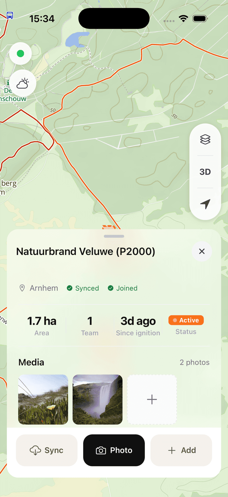
Basta abrir a app, tirar uma foto, pronto. Agora o comandante do incidente e o analista veem o que você vê. E também o investigador de incêndios florestais 2 anos depois.
Upload de fotos, vídeos e imagens de drones
Marcação GPS automática e carimbos de tempo
Grandes alvos de toque para mãos com luvas
Sem sinal? Sem problema.
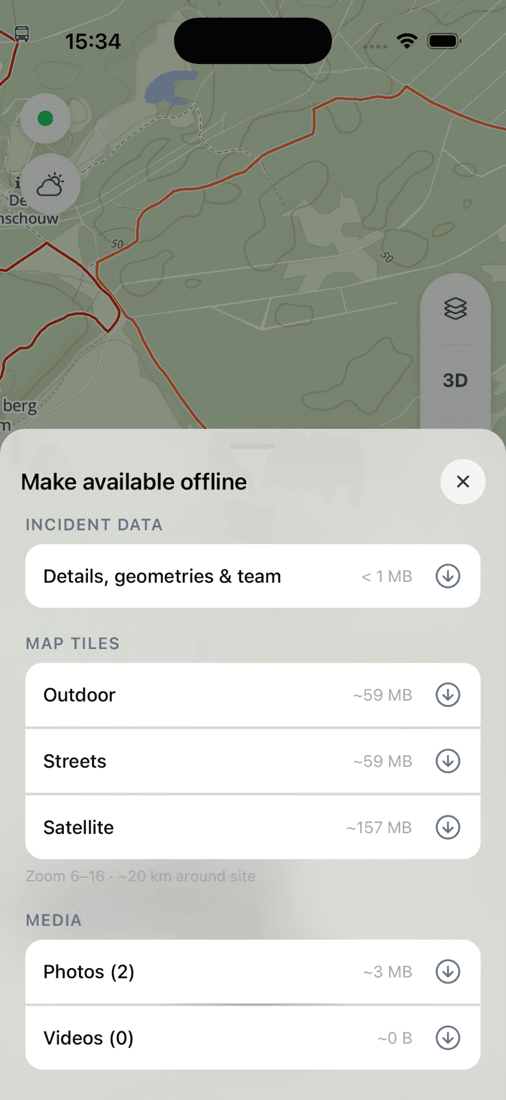
A maioria das apps de campo falha no momento em que perde a receção. O FieldKit foi construído offline-first. Capture fotos, vídeos e observações sem qualquer ligação de rede. Tudo fica em fila local e sincroniza automaticamente assim que a conectividade volta — sem perda de dados, sem duplicados, sem envios manuais.
Funcionalidade completa sem cobertura de rede
Sincronização automática em segundo plano quando a ligação regressa
Sem perda de dados — cada captura é colocada em fila e verificada
Do campo para o analista, instantaneamente
Cada captura flui diretamente para a plataforma Analysis. Sem anexos de email, sem transferências de ficheiros, sem pens USB perdidas, sem metadados perdidos na partilha por WhatsApp. O seu analista vê o que o campo vê — em tempo real ou após sincronização.
FieldKit
Captura no campo
Sincronização automática
Sem transferência manual necessária
Analysis
Panorama completo para decisões
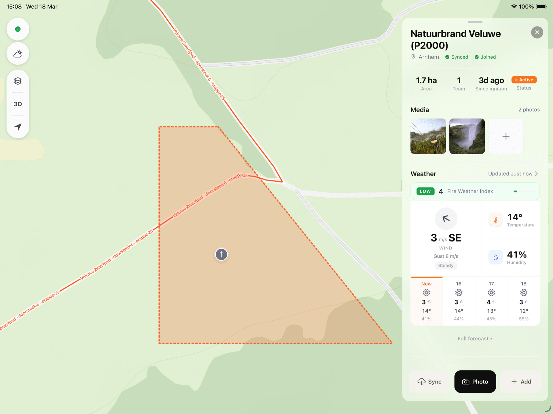
Integração direta com o painel Analysis
Todos os dados de campo organizados por incidente, data e equipa
Cadeia de custódia completa para cada observação
Construído para todos no campo
Bombeiros, florestais, equipas de proteção civil, guardas florestais — o FieldKit não se preocupa com organigramas. É uma ferramenta utilitária que qualquer pessoa pode pegar e usar. 'Carrega no FieldKit' deve parecer tão natural como 'tirar uma foto.'
Sem contas por utilizador ou permissões complexas
Marca mínima — parece uma ferramenta do sistema, não uma app
Funciona entre agências e jurisdições
Os dados do FieldKit fluem diretamente para a plataforma Analysis para o panorama completo.
Descubra o AnalysisObtenha o FieldKit para a sua equipa
O FieldKit está incluído em cada subscrição Analysis. Fale connosco sobre como configurar as suas equipas de campo.