The single source of truth for wildfire intelligence
Stop switching between weather sites, spreadsheets, and email threads. Every data stream your team needs — unified, visualized, and ready for decisions.
Your data is everywhere. Your picture is nowhere.
Fire analysts spend hours gathering weather data from five different sites, cross-referencing satellite imagery, and manually building briefings. Critical information lives in personal email threads. When an incident starts, the scramble begins again.
Weather data scattered across multiple portals
No unified view during incident response
Hours spent on daily briefings that should take minutes
Historical incident data lost or buried in archives
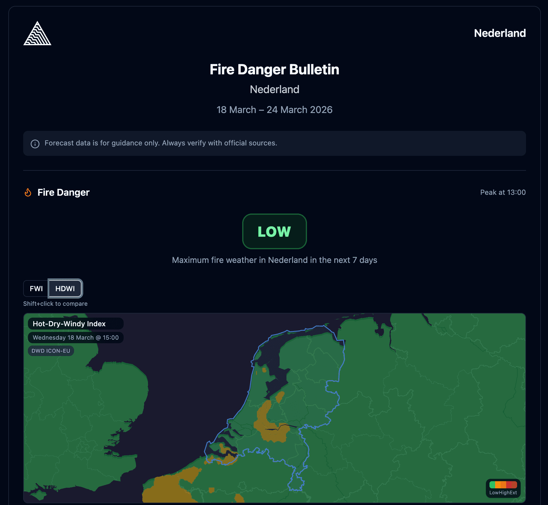
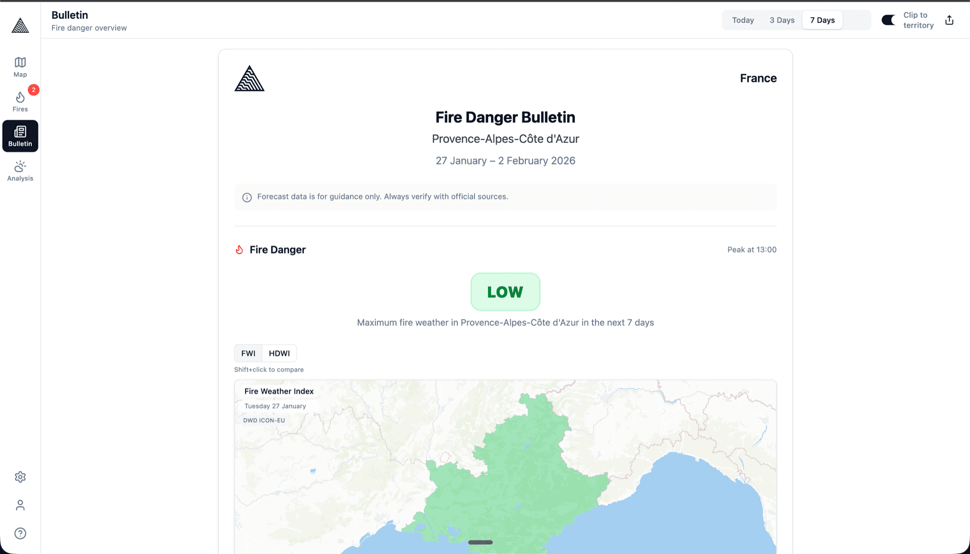
Daily intelligence for your entire team
Create professional fire weather bulletins in minutes. Wildflyer aggregates weather models, computes danger indices (FWI, EFFIS classifications), and lets you publish a clear daily picture that your whole team can access — from station commanders to field crews.
Automated danger classification with customizable thresholds
Multi-model weather comparison at a glance
One-click publishing to your entire organization
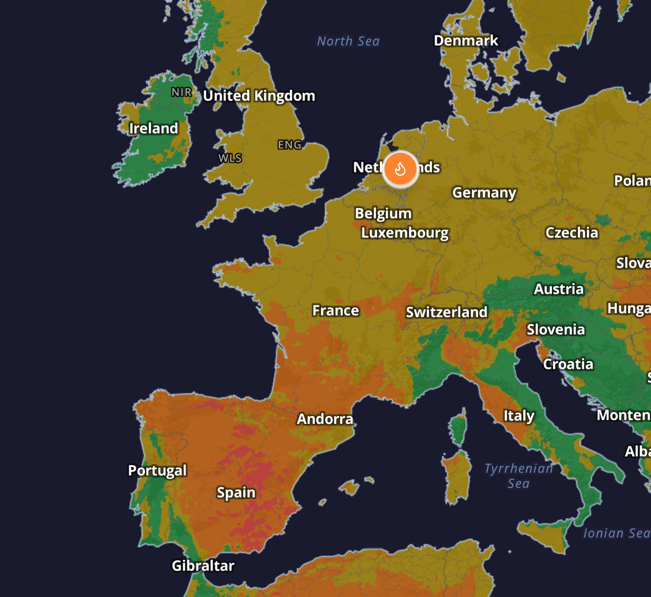
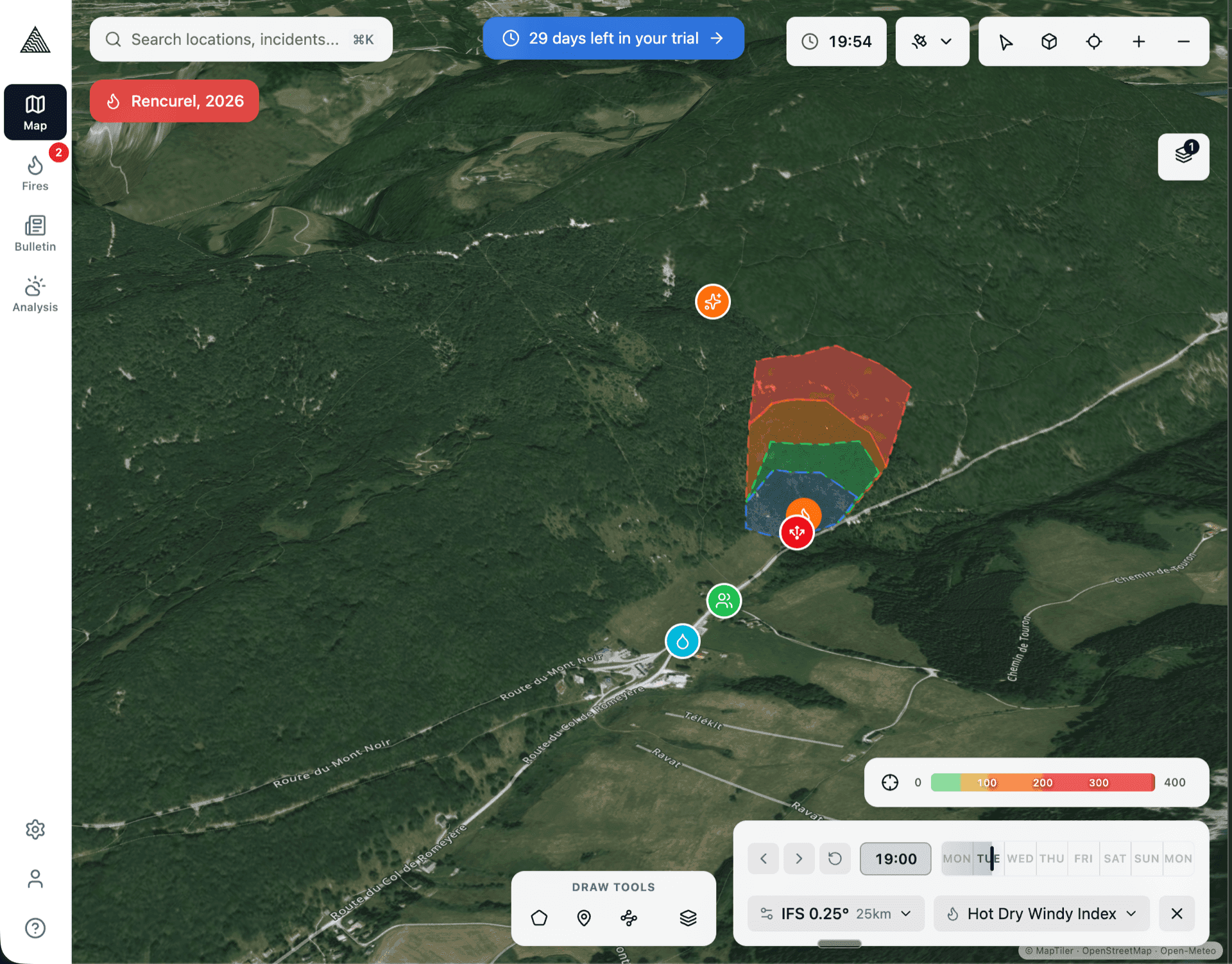
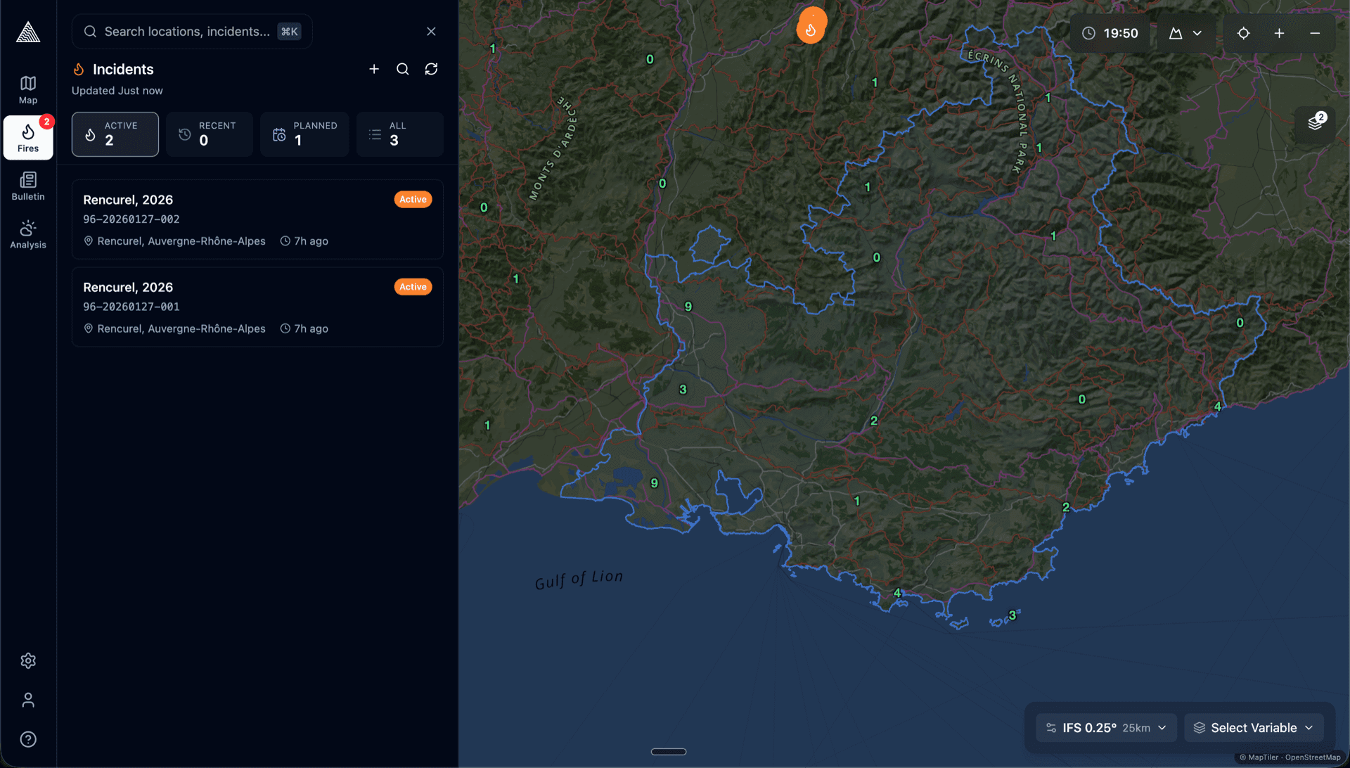
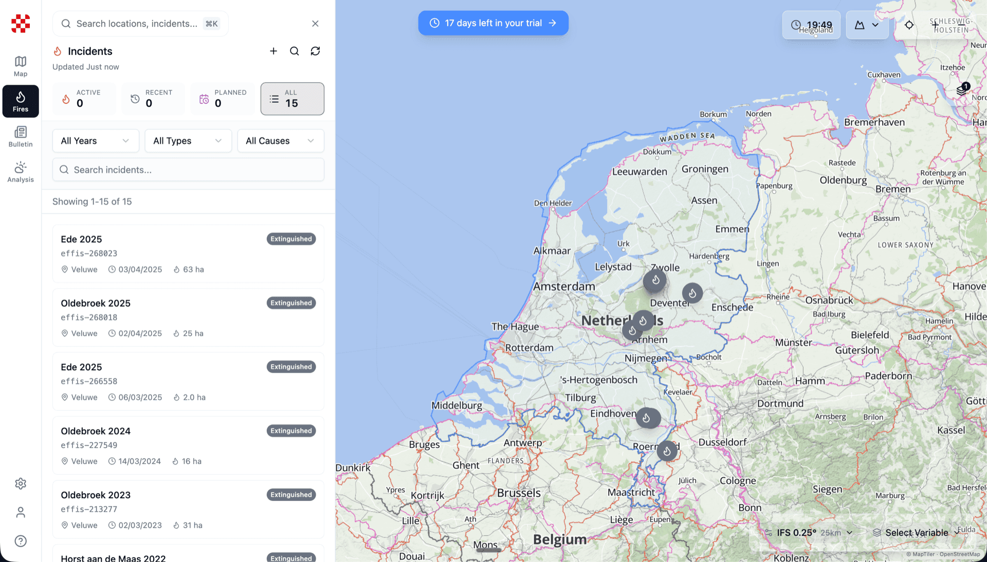
Every data stream, one view
Satellite imagery, weather data, fire perimeters, field observations, drone footage — all overlaid on a single map. Replay incidents from hours ago or years ago. Build the complete picture that incident command needs.
Multi-layer map with satellite, weather, and perimeter data
Historical incident analysis — look back days, months, or years
Field observations from FieldKit flow in automatically
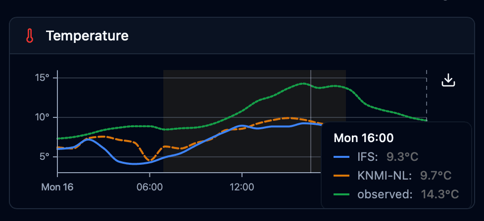
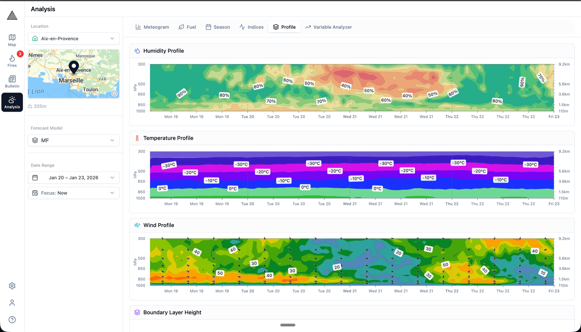
Fire-specific weather intelligence
Compare multiple weather models side by side. Vertical profiles, meteograms, soil moisture trends, humidity charts — all computed and visualized for fire analysis. Not generic weather data, but the specific metrics fire professionals rely on.
Side-by-side model comparison (ECMWF, GFS, and more)
Vertical profiles and atmospheric stability analysis
Soil moisture, humidity trends, and drought indices
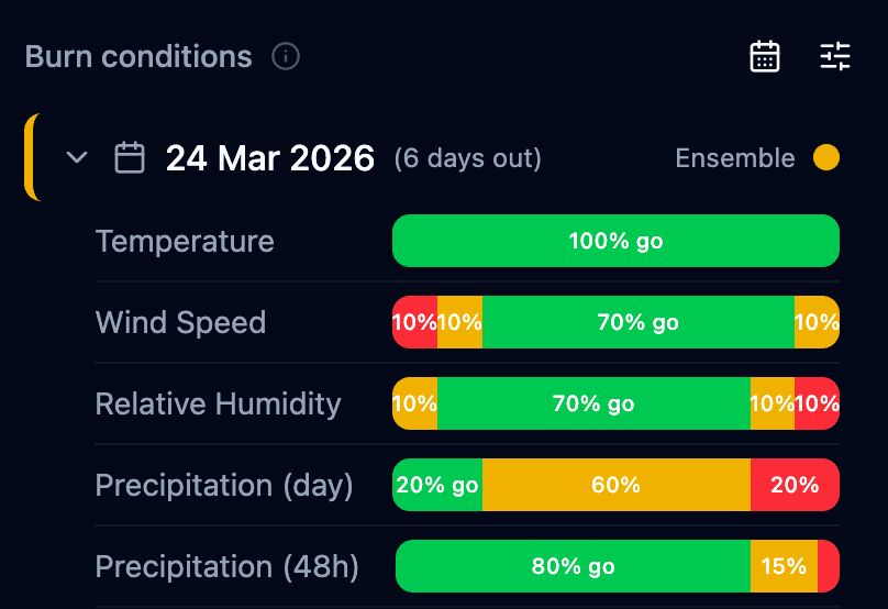
Are we going to burn?
Plan prescribed burns with weather-informed go/no-go decisions. Set your condition thresholds, and Wildflyer evaluates upcoming weather windows with a clear stoplight system. No more guessing, no more cancelled burns due to missed weather windows.
Weather condition evaluation with stoplight indicators
Multi-day forecast windows for burn scheduling
Complete burn documentation and outcome tracking
Analysis is even more powerful with field data flowing in automatically.
Explore FieldKit
See it for yourself
Book a 30-minute call and we'll walk you through the platform with your own region's data.